Drone technology is becoming a powerful tool in reshaping urban management across India. In Jodhpur, this advancement is not just about flashy tech—it’s about solving real problems in property recordkeeping, tax assessment, and infrastructure planning. With sprawling neighborhoods, rapid development, and gaps in traditional surveying methods, Jodhpur Municipal Corporation is embracing this cutting-edge approach to build a smarter, more efficient city.
This article delves into how Jodhpur Municipal Corporation is integrating drone technology into its core governance processes. From improving accuracy in property surveys to enhancing tax revenues and urban development, the technology is changing the way the city functions. We’ll also explore key benefits, challenges, and what this shift means for the future of municipal governance in India.
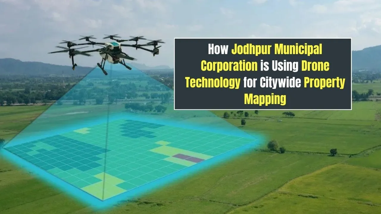
How Drone Technology is Supporting Property Mapping and Urban Governance
The use of drone technology in Jodhpur is redefining how cities manage growth and public services. Unlike older survey techniques, drones enable fast and accurate aerial mapping, capturing high-resolution images from above. These visuals are then processed using GIS mapping tools to create detailed layouts of properties, roads, and land use. This data isn’t just for recordkeeping—it’s powering decisions around tax assessment, smart city planning, and even illegal construction detection. By turning aerial data into actionable insight, Jodhpur is setting an example for other municipalities to follow.
Overview of Drone Technology in Jodhpur’s Urban Mapping
| Element | Details |
| Drone Type Used | High-resolution aerial mapping drones with GIS integration |
| Area Covered | Entire municipal boundary including both core and outer zones |
| Key Objective | Update property records, increase tax revenue, support planning |
| Data Output | 2D/3D digital maps, property outlines, structural details |
| Department Involved | Jodhpur Municipal Corporation, Urban Planning Division |
| Frequency of Operation | Phased surveys across wards, repeated annually or bi-annually |
How Drone Technology Helps in Property Mapping
Drone technology allows Jodhpur to move beyond slow and often inaccurate manual property surveys. Traditional methods rely heavily on field teams who inspect properties individually, which not only takes time but leaves room for errors or underreporting. Drones cover wide areas within hours, capturing detailed and uniform data that forms the backbone of updated property maps.
This is especially important in detecting previously unregistered or modified properties. Drones can identify extensions, new constructions, and encroachments that haven’t been declared. By integrating this visual data into GIS platforms, the municipal corporation gets a precise, bird’s-eye view of every plot—urban or rural.
Improving Tax Collection Using Drones
One of the standout benefits of using drone technology is its ability to significantly boost property tax assessment. By cross-verifying the drone-collected data with existing municipal records, discrepancies become easy to spot. Structures that were under-assessed or completely missing from records are now visible and measurable.
This has led to a more equitable taxation system. Property owners are charged based on actual built-up area and usage type, leaving less room for underreporting. The result is not only increased revenue for the corporation but also improved transparency in how tax bills are calculated.
With a fairer tax system, public trust is also growing. Citizens are more likely to pay when they know that assessments are accurate and applied equally. These funds are redirected into vital public services, from sanitation to street lighting and infrastructure upgrades.
Supporting Smart Urban Planning
Smart city planning thrives on real-time, reliable data—and that’s exactly what drone technology delivers. With updated aerial visuals, planners in Jodhpur can identify growth hotspots, traffic bottlenecks, and underdeveloped areas. This insight is used to make informed decisions about future development.
Whether it’s choosing where to build a new road, creating zoning laws, or monitoring green spaces, the drone data gives planners a visual framework. The ability to simulate development plans on 3D maps allows for more accurate forecasting and project execution.
Beyond urban development, drones are aiding in disaster response planning and environmental conservation. The city can now monitor flood zones, illegal dumping sites, or areas prone to erosion, and respond proactively.
Two Key Uses of Drone Technology in Jodhpur:
- Property Record Updates:
Drones enable the municipal body to maintain up-to-date digital property records by identifying inconsistencies between on-ground reality and municipal archives. This supports real-time updates and better service delivery. - Detection of Unauthorized Buildings:
Aerial scans quickly highlight unauthorized structures—like rooftop additions or basement expansions—that violate zoning regulations. These can then be reviewed and acted upon through legal and administrative processes.
Benefits of Using Drone Technology
The adoption of drone technology is bringing several immediate and long-term benefits to Jodhpur’s municipal operations:
- Efficiency and Speed: A single drone can survey multiple neighborhoods in a fraction of the time taken by human surveyors.
- Accuracy: With centimeter-level precision, the data produced is far superior to paper records or outdated maps.
- Cost-Effectiveness: While initial investment is high, the long-term savings in manpower and reduced disputes make it worthwhile.
- Transparency: By making digital records accessible to the public, disputes are minimized and trust in governance increases.
- Data Integration: Drone visuals are fed into GIS systems, creating a powerful planning and decision-making tool.
These benefits are positioning drone integration as not just a technical upgrade, but a governance revolution.
Challenges Faced in Drone Implementation
Despite its advantages, rolling out drone technology hasn’t been without hurdles. Weather plays a big role—dust storms, heat, or rain can delay operations or impact image clarity. Regulatory approvals are also time-consuming, requiring clearances from multiple departments, including aviation authorities.
On the technical front, there’s a lack of trained personnel to operate drones and interpret GIS data. Public concerns about surveillance and privacy also need to be addressed through transparent communication and policy safeguards.
Additionally, integrating the new drone data with legacy software systems used by local authorities can be challenging and often requires custom solutions.
Future of Drone Technology in Urban Governance
Looking ahead, drone technology is poised to become a staple in municipal governance. Beyond property mapping, potential uses include monitoring traffic congestion, tracking construction timelines, inspecting infrastructure like bridges and drains, and even overseeing waste management.
For Jodhpur, the successful implementation of this technology marks the beginning of a smarter, data-driven governance era. As other cities observe its progress, there’s potential for this model to be replicated across India, transforming urban administration at scale.
The long-term vision is a fully digitized municipal management system, where real-time aerial data supports every policy and project—from slum rehabilitation to smart mobility planning.
FAQs
1. What is the main reason Jodhpur is using drone technology for mapping?
The primary goal is to create accurate property records, identify unregistered properties, and support tax collection and urban planning.
2. How do drones help improve tax collection?
They identify built-up areas and unauthorized constructions, allowing fair and updated property tax assessments.
3. Is the drone-collected data reliable?
Yes, drone data is highly accurate and integrated with GIS systems, which makes it ideal for municipal applications.
4. Are there privacy concerns with drones flying over properties?
Yes, but the data collected is used only for official purposes like mapping and is handled under strict privacy protocols.
5. Can other cities adopt the same drone mapping approach?
Absolutely. Jodhpur’s model is scalable and can be adopted by other municipal bodies looking to improve urban management.
Conclusion
Jodhpur is proving that drone technology isn’t just a futuristic trend—it’s a practical solution to everyday governance challenges. From improving property records to ensuring fair tax collection and enabling smarter city planning, the impact is real and measurable. As the city continues to evolve, this technology will serve as a key driver for transparent, efficient, and responsive municipal services.
If you’re curious about how technology is reshaping Indian cities, or want to explore more about property digitization and planning, drop a comment or share your thoughts. You can also check out related content on digital governance and innovation in urban India.