Jodhpur Municipal Corporation is stepping into a new era of environmental responsibility by launching a modernized tree census and biodiversity mapping project. In a time when urbanization is rapidly consuming green areas, this initiative reflects a much-needed shift in how Indian cities manage their natural resources. Jodhpur, known for its desert climate and cultural heritage, is now emerging as a pioneer in blending smart technology with ecological awareness.
This article dives deep into Jodhpur’s fresh strategy for cataloging its green assets. From GPS-enabled tracking to public involvement in conservation, the city is reimagining how local governments can address environmental challenges. We’ll break down the key tools, expected outcomes, community roles, and the bigger vision behind this innovative approach.
Jodhpur Municipal Corporation: Blending Technology with Ecology
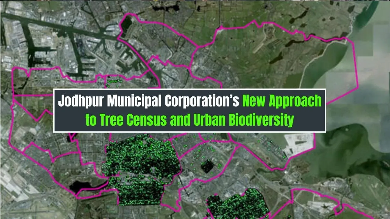
At the heart of this initiative lies a strategic shift by the Jodhpur Municipal Corporation towards sustainable city management. With climate concerns rising and natural habitats shrinking, the Corporation aims to collect precise, actionable data through a tech-enabled tree census and biodiversity index. By integrating GPS tools, digital platforms, and scientific methodology, they are creating a solid base for informed decision-making. This approach not only improves urban greenery but strengthens ecological balance and biodiversity protection in the long run.
Overview of the Initiative
| Aspect | Details |
| Focus | Tree census, biodiversity mapping, green planning |
| Tools Used | GPS tagging, GIS mapping, mobile-based survey applications |
| Key Objectives | Urban greenery protection, environmental data accuracy, public awareness |
| Coverage Area | Entire city zones under Jodhpur Municipal Corporation |
| Public Participation | Citizen reporting tools, school engagement, NGO collaboration |
| Expected Outcome | Improved green cover, balanced development, biodiversity conservation |
Why Tree Census Matters
A modern tree census does more than count trunks—it measures the ecological pulse of a city. For Jodhpur, this census offers a window into the health, diversity, and distribution of its urban forest. It helps identify the density of native species, recognize vulnerable zones, and prepare long-term strategies for sustainable urban development. When urban greenery is mapped correctly, cities can mitigate heat island effects, improve air quality, and promote mental well-being among residents.
For a desert-edge city like Jodhpur, where water scarcity and temperature extremes are constant challenges, maintaining green cover becomes even more crucial. The Jodhpur Municipal Corporation recognizes this and is using the data to guide everything from road design to housing plans—ensuring ecological considerations are no longer an afterthought in city planning.
Digital Tools and Smart Mapping
Abandoning outdated manual records, Jodhpur Municipal Corporation now uses technology to bring precision and efficiency into tree monitoring. Field teams are equipped with GPS-enabled devices that record the exact location of every tree. GIS (Geographic Information System) tools help visualize tree distribution patterns, monitor growth trends, and detect ecological gaps across different city zones.
Mobile-based survey applications allow on-the-ground personnel to capture information about tree health, height, age, and species in real time. These inputs are fed into a central digital platform that can be accessed and updated continuously, forming a living map of Jodhpur’s green assets.
This tech-driven tree management system is not only faster and more accurate but also transparent. It ensures accountability and provides a long-term solution for biodiversity monitoring and smart city planning.
Urban Biodiversity: A Growing Need
Urban biodiversity plays a vital role in maintaining ecological harmony. It includes everything from birds, insects, and microfauna to the varied plant species co-existing within city limits. In Jodhpur’s case, unique desert-adapted flora and fauna face growing threats from construction, pollution, and human encroachment.
The tree census forms the foundation of a broader biodiversity mapping project that aims to protect these native species. By identifying ecological hotspots, the Jodhpur Municipal Corporation can prioritize areas for conservation or eco-restoration. Butterfly gardens, bird sanctuaries, and community green zones are now being factored into municipal plans, promoting both environmental health and public enjoyment.
Urban biodiversity also improves the city’s resilience against climate change, creating a safety net of natural systems that support air purification, rainwater absorption, and temperature control.
Benefits of Jodhpur’s New Approach
- Data-Driven Decisions: The integration of digital tools provides highly accurate environmental data.
- Smarter Urban Planning: Development projects are better aligned with environmental priorities.
- Enhanced Public Health: Improved air quality and more green spaces mean healthier living conditions.
- Preservation of Local Ecology: Native trees and species are identified and protected through targeted programs.
- Climate Adaptation: Biodiverse spaces help cities cope with floods, droughts, and heatwaves.
Key Features of the Tree Census
- GPS and GIS Integration: Every tree is geo-tagged with details like species, health status, and age.
- Live Monitoring System: Updates on tree health, pruning needs, or disease outbreaks are recorded instantly.
- Species Diversity Check: Differentiation between native and invasive species enables better green management.
- Health and Risk Assessment: At-risk trees are flagged for treatment or removal if necessary.
- Environmental Education Integration: Schools are involved to create awareness about local plant life and ecosystems.
Community Involvement and Education
What makes this initiative particularly strong is its grassroots connection. Recognizing that long-term success depends on community support, Jodhpur Municipal Corporation has opened doors for public engagement. Residents can use mobile apps to report tree damage or illegal cutting, nominate areas for plantation, or volunteer for local green drives.
NGOs and academic institutions are also stepping in, offering technical help, organizing biodiversity walks, and running tree adoption campaigns. Schools and colleges are introducing green clubs, where students learn about sustainability, native species, and the importance of ecological balance.
This citizen participation is not only enriching the census data but building a culture of ownership and pride in local biodiversity.
Two Important Steps Taken by Jodhpur Municipal Corporation:
- Partnerships with Environmental NGOs:
- By collaborating with regional and national environmental organizations, the city gains access to expert knowledge, wider volunteer networks, and added resources for educational campaigns and tree care.
- By collaborating with regional and national environmental organizations, the city gains access to expert knowledge, wider volunteer networks, and added resources for educational campaigns and tree care.
- Creating a Public Green Database:
- A digital platform has been launched where residents can explore tree census data, track green projects, and get involved in feedback and reporting. This transparent system builds trust and encourages civic responsibility.
Future Plans
The vision of Jodhpur Municipal Corporation doesn’t end with the initial census. Plans are underway to integrate drone surveillance, artificial intelligence, and climate impact forecasting tools into the program. These upgrades will offer deeper insights into biodiversity trends, land use changes, and urban greening progress.
The long-term goal is to develop an adaptable green infrastructure model that can be replicated in other Indian cities. Jodhpur’s forward-thinking approach is already attracting attention from planners in similar ecological zones who want to balance development with environmental conservation.
FAQs:
1. What is the aim of Jodhpur’s tree census?
The primary goal is to record, protect, and improve the city’s green cover by using accurate, tech-based data collection methods.
2. How can I report a tree issue or suggest a location for plantation?
You can use the mobile app linked to the municipal platform to submit tree-related concerns or suggestions directly to authorities.
3. Why is biodiversity mapping important for a desert city like Jodhpur?
Mapping helps protect native species that are uniquely adapted to arid conditions and face higher risk due to urban expansion.
4. What role do NGOs and schools play in this initiative?
They help spread awareness, provide volunteers, and educate younger generations on the importance of urban ecology.
5. Can this model be used in other cities?
Yes, the approach combines scalable technology and community action, making it a suitable model for cities across India.
Conclusion:
Jodhpur is showing that smart growth and ecological protection can go hand in hand. By modernizing its tree census and promoting biodiversity, the Jodhpur Municipal Corporation is setting a new benchmark for sustainable city management. The project not only safeguards the environment but also builds a stronger, greener bond between citizens and their city.
If you’re a resident or environmental enthusiast, this is the time to get involved. Support local green drives, plant native trees, or explore the open biodiversity data platform to learn more. Cities thrive when communities care.